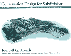
Conservation Design for Subdivisions
A Practical Guide to Creating Open Space Networks
by Randall
Arendt
Island Press
(Copublished by the American Planning Association and
the American Society of Landscape Architects)
 Conservation Design for Subdivisions presents a simple step-by-step approach to designing subdivisions around the central organizing principle of protecting open space, and shows how communities can adopt new standards in their plans and ordinances to ensure that future developments follow this design approach in a way that will ultimately produce an interconnected network of conservation lands throughout their land areas.
This is a practical handbook for landowners, local officials, residential developers, engineers, and surveyors that explains how to lay out new neighborhoods where half to three-quarters of the land remains as permanent open space. This result is achieved in a "density-neutral" manner that respects the equity of landowners and the rights of developers to create the full number of houselots allowed under current zoning.
The approach described in this handbook provides a fair and equitable means of balancing conservation and development objectives, and offers an opportunity for developers and conservationists to meet in the middle, creating more livable communities in the process.
The key to conserving natural resources and cultural features within new developments is to rearrange density on each subdivision tract as it is being laid out, so that only half (or less) of the developable land is cleared, graded, and turned into lawns, driveways, streets, and cul-de-sacs. In this way, homes are built in a less land-consumptive fashion allowing the balance of the property to be permanently protected and added to an interconnected system of green spaces and greenway corridors crisscrossing towns, townships, and counties where these principles are incorporated into the basic design standards for new development.
The handbook contains fully-illustrated case examples showing the four-step methodology applied to seven properties exhibiting a wide range of pre-existing conditions, including riparian, lakefront, and coastal sites with woodlands, meadows, and fields. These sites also contain a variety of natural, cultural, historic, and features such as critical habitats, environmentally sensitive resources, noteworthy geological formations, architectural landmarks, stone walls, battlefield earthworks, and scenic viewsheds. Most of these special areas are accorded zero protection under most zoning and subdivision codes, which allow all land except floodplains, wetlands, and steep slopes to be fully developed.
With its model regulatory language, this handbook provides local officials with the means to correct the deficiencies in their present ordinances. The clear graphics and highly readable text provide lay readers with the understanding they need to make a persuasive case to their local leaders, for the adoption of such standards to prevent conventional land-use regulations from producing "wall-to-wall subdivisions" across their community -- as they undoubtedly will, in the absence of a different model that accommodates development in a more compact and environmentally sensitive fashion.
Special Features
160 pages - 22 color plates - Binding sewn with thread (not glued) - Step-by-step site plans for seven properties - Model ordinance language (key provisions)
Selected Chapters: Main Points
Advantages of Conservation Design
Explores the economic, environmental, ecological, social, and recreational advantages of conservation subdivisions.
Roles and Responsibilities of Various Parties
Shows how different groups -- from planners and developers to planning commissioners and landowners -- can encourage (or require) conservation subdivision design.
Steps Involved in Designing Conservation Subdivisions
Outlines a step-by-step process communities can use to collect pertinent resource information and to shape the resulting pattern of conservation and development.
Linked Conservation Lands in Open Space Networks
Demonstrates how to use tools such as area-wide maps to help communities protect their "green infrastructure" with new open space each time land is subdivided, in an interconnected way.
Conservation Subdivision Design on Seven Sites
Shows how conservation planning principles are applied to protect woodland habitat, productive cropland, historic resources, and scenic landscapes on seven different properties, illustrating, inland, riparian, lakefront, and coastal situations.
Regulatory Improvements
Suggests specific ways to modify zoning and subdivision regulations to codify conservation practices, explaining the technical model ordinance language contained in the appendix.
Managing Conservation Lands
Addresses many ownership and management issues, and describes how communities can ensure continual maintenance of common and “non common open space” according to approved plans specific to each site.
Ordering Information
To order copies of this book, please consult the following link at the website of Island Press: islandpress.org/randall-g-arendt
home services about contact links reviews
 Conservation Design for Subdivisions presents a simple step-by-step approach to designing subdivisions around the central organizing principle of protecting open space, and shows how communities can adopt new standards in their plans and ordinances to ensure that future developments follow this design approach in a way that will ultimately produce an interconnected network of conservation lands throughout their land areas.